EP-F-001. Poster Project Sharjah (PDF) Oman Peninsula Projects.
BASÍLICA DE CONÍMBRIGA
EP-F-002. Basílica de Conímbriga (Español) (PDF) Levantamiento de restos funerarios de le época medieval mediante
sistema láser-escáner 3D a escala 1:200 y del yacimiento arqueológico
de Conimbriga a escala 1:500.
EP-F-003. Basílica de Conímbriga (English) (PDF) Topographic survey of a funeral site of medieval time by means of
laser scanner 3D in the scale 1:200 and of a archological area of
Conimbriga in the scale 1:500.
EP-F-004. Basílica de Conímbriga (Français) (PDF) Levé d'un site funéraire de l'époque médiévale au moyen du laser
scanner 3D à l'échelle 1:200 et du site archéologique de Conimbriga à
l'échelle 1:500.
CASTILLO DE ADRADA
EP-F-005. Castillo de Adrada (Español) (PDF) Levantamiento topográfico y generación del modelo tridimensional
del “Castillo de la Adrada” y de sus alrededores. Elaboración de un
documento multimedia del castillo.
EP-F-006. Castillo de Adrada (English) (PDF) Topographic survey and creation of a three-dimensional model of
"Castillo de la Adrada" and its environment. Elaboration of a
multimedia document on the castle.
EP-F-007. Castillo de Adrada (Français) (PDF) Levé topographique et génération d’un modèle tridimensionnel du
“Castillo de la Adrada” et de son environnement. Elaboration d’un
document multimédia sur le château.
CASTILLO DE VILLAVELLID
EP-F-008. Poster del Castillo de Villavellid (JPEG) Levantamiento topográfico por medio de Láser escáner
EP-F-009. Castillo de Villavellid (Español) (PDF) Levantamiento topográfico del “Castillo de Villavellid” con
métodos tradicionales y sistemas láser escáner 3D.
EP-F-010. Castillo de Villavellid (English) (PDF) Survey of "Castillo de Villavellid" realized with traditional
techniques and with laser scann 3D system.
EP-F-011. Castillo de Villavellid (Français) (PDF) Levé topographique du “Castillo de Villavellid” réalisé avec les
techniques traditionnelles et avec le système laser scanner
3D.
CLAUSTRO DE SIGÜENZA
EP-F-012. Claustro de Sigüenza (Español) (PDF) Levantamiento topográfico del claustro de la catedral de Sigüenza
a escala 1:200.
EP-F-013. Claustro de Sigüenza (English) (PDF) Topographic survey of the cloister of the cathedral of Sigüenza in
the scale 1:200
EP-F-014. Claustro de Sigüenza (Français) (PDF) Levé topographique du cloître de la cathédrale de Sigüenza à
l’échelle 1:200
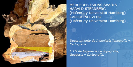
COVA GRAN
EP-F-015. Cova Gran (Español) (PDF). Proyecto e implantación de una red básica mediante GPS para dar
cobertura al yacimiento del refugio paleolítico de Cova Gran. Obtención
de cartografía y un MDT.
EP-F-016. Cova Gran (English) (PDF) Project of establishment of a basic network by means of a GPS to
connect the paleolithic refuge of Cova Gran. Obtaining of a cartography
and a digital terrain model of the place.
EP-F-017. Cova Gran (Français) (PDF) Projet d'implantation d'un réseau de base au moyen d'un GPS pour
rattacher le refuge paléolithique de Cova Gran. Obtention d'une
cartographie et d'un modèle digital de terrain du lieu.